Kamalapuram Fm
Type Locality and Naming
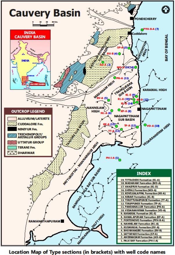
SUBSURFACE: The type section is located at exploratory well Kamalapuram-A(depth interval: 2450-1770 m), on the Karaikal ridge at the tri-junction of Tranquebar, Tanjore and Nagapattinam subbasins. The hypostratotype is in the Well Adiyakamangalam-A(depth interval: 2670-1830 m). It was named after the Kamalapuram village by ONGC team guided by Venkatarengan et al.(1993) and issued as Document-VII by KDMIPE, ONGC, Dehradun (1993).
[Figure 1: Type-section Map of Subsurface Formations]
Lithology and Thickness
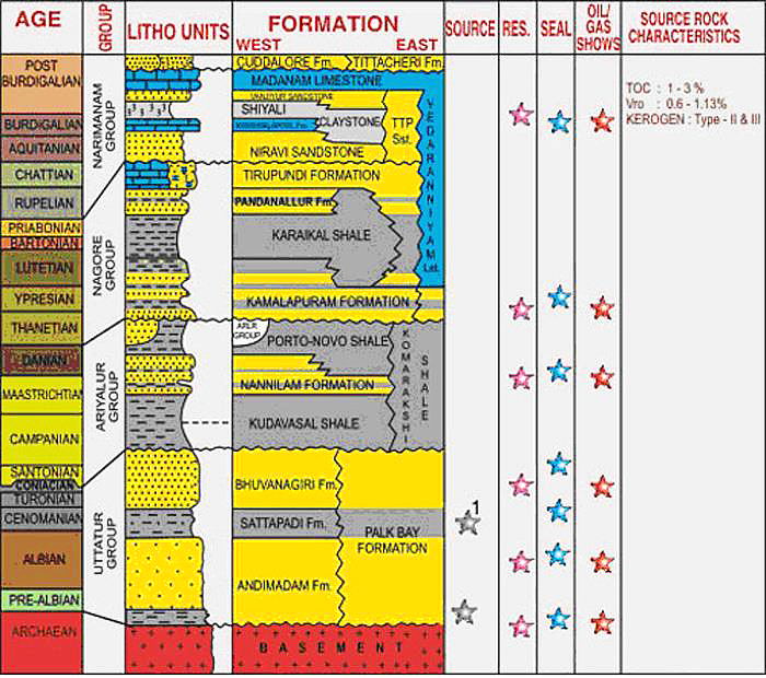
Clayey sandstone. The formation is characterized by alternations of clayey sandstones and shale bands. Sandstone is grayish white, compact, hardtop subrounded, well sorted, coarse to pebbly, subangular, calcareous and occasionally micaceous and pyritiferous. The shale is light gray to dark gray, compact, moderately hard, fissile, with occasional brownish limestone streaks present along the fissile planes with encrustations of pyrite. Its thickness varies from 680-840 m. Part of Nagora Gr.
[Figure 2: Generalized Stratigraphy and Petroleum System of Cauvery Basin (from dghindia.gov.in)]
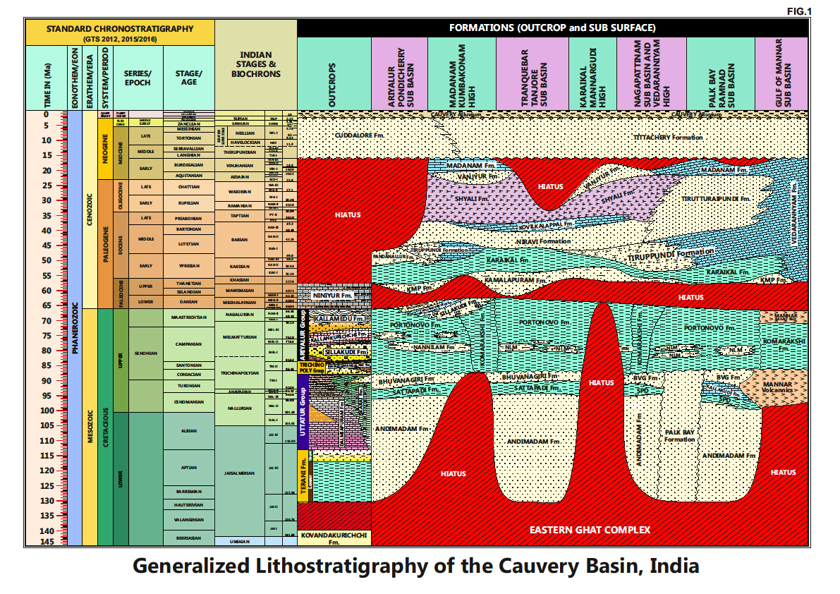
[Figure 3: Generalized Stratigraphy of Cauvery Basin (Provided by A. Nallapa Reddy & R. Nagendra)]
Relationships and Distribution
Lower contact
Unconformable with the Portonovo Fm / Komarakshi Fm.
Upper contact
Conformable with the Karaikal Fm.
Regional extent
This formation occurs in the entire basin, but with two main depocenters: one n the Ariyalur-Pondicherry subbasin and the other along the Karaikal Ridge area.
GeoJSON
Fossils
Planktonic foraminifera: Globotruncana arca, Igorina pusilla, Morozovella velascoensis, M. subbotinae, M. spinulosa, M. aragonensis.
Age
Depositional setting
Outer neritic-Upper bathyal.
Additional Information
This formation consists of two Members named as Tanjore Limestone Member and Mannargudi Shale Member.


